
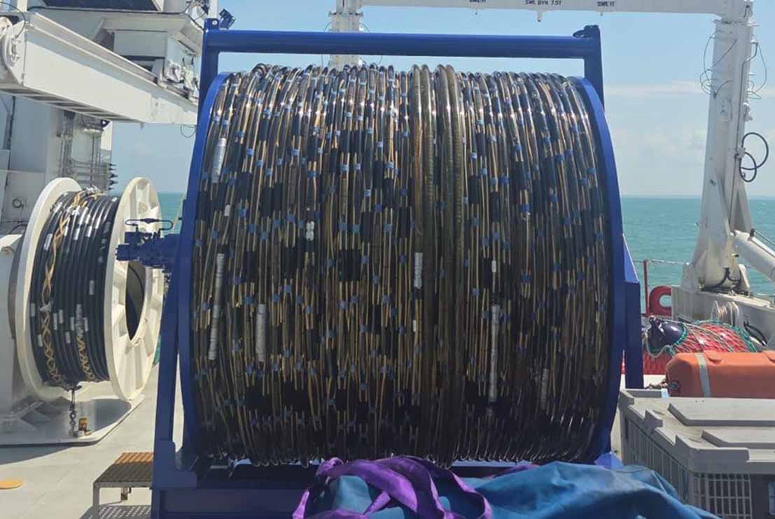
The Marine Seismic Streamer is a high-resolution seismic receiver system designed to acquire reflected acoustic signals during offshore geophysical and geotechnical survey operations. Towed behind the survey vessel in conjunction with a seismic sound source, the streamer records subsurface reflections from geological layers beneath the seabed, providing detailed information on sediment stratigraphy, geological structures and subsurface conditions for offshore engineering and site investigations.
The Marine Seismic Streamer consists of a series of hydrophone arrays housed within a flexible, fluid-filled cable that is deployed at a controlled depth behind the survey vessel. Acoustic pulses generated by the seismic sound source penetrate the seabed and are reflected by subsurface geological interfaces. These reflected signals are detected by the hydrophones and transmitted to the onboard acquisition system, where they are processed and displayed in real time. Integrated with GNSS positioning systems, Motion Reference Units (MRU), gyrocompasses and navigation software, the system ensures that all seismic data are accurately geo-referenced throughout the survey operation.
The Marine Seismic Streamer provides high-sensitivity signal acquisition with excellent signal-to-noise performance and high vertical resolution. The modular streamer configuration can be adapted to suit varying water depths, survey objectives and geological conditions, enabling efficient acquisition of high-quality seismic data for both shallow and intermediate-depth investigations. Real-time quality control allows survey personnel to monitor signal integrity, streamer geometry and data coverage throughout the survey.
The Marine Seismic Streamer is widely used for offshore geophysical surveys, marine geotechnical site investigations, pipeline and cable route surveys, and offshore wind farm developments. The system provides detailed images of subsurface geology, supporting geological interpretation, geohazard identification, route optimisation, foundation assessments and engineering design, ensuring reliable subsurface information for the planning and execution of offshore infrastructure projects.