
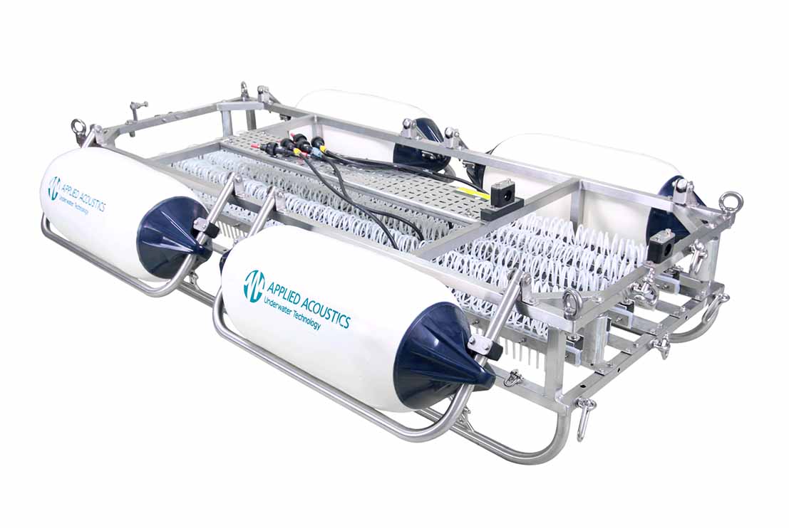
The Seismic Sound Source is a high-performance acoustic energy source designed for high-resolution sub-bottom profiling and shallow seismic surveys during offshore geophysical and geotechnical investigations. The system generates controlled acoustic pulses that penetrate beneath the seabed, enabling the imaging of sub-surface geological formations, sediment layers and buried features essential for offshore engineering design and site characterization.
The Seismic Sound Source operates by generating repeatable acoustic pulses through an array of transducers, producing broadband energy that propagates through the water column and penetrates the seabed. Reflected acoustic signals from subsurface interfaces are recorded by a compatible seismic receiver or streamer, allowing the thickness, continuity and geometry of sedimentary layers to be interpreted. The system interfaces seamlessly with onboard navigation and acquisition software, ensuring that all seismic data are accurately synchronized with vessel positioning for real-time quality control and subsequent processing.
Designed for continuous offshore operation, the Seismic Sound Source provides adjustable output levels and operating frequencies to optimise sub-bottom penetration and vertical resolution under varying seabed conditions. The compact modular design allows rapid mobilisation on a wide range of survey vessels while providing stable and repeatable acoustic performance throughout the survey. The system is capable of imaging shallow geological structures, buried channels, fault zones, hard strata and other subsurface features that may influence offshore engineering and construction activities.
The Seismic Sound Source is widely used for offshore geophysical surveys, marine geotechnical site investigations, pipeline and cable route surveys, offshore wind farm developments, harbour and port developments, dredging investigations, offshore construction support and environmental baseline studies. By providing high-resolution images of the subsurface, the system supports geological interpretation, geohazard identification, route optimisation and foundation assessments, ensuring that offshore engineering projects are planned and executed using reliable subsurface information.