
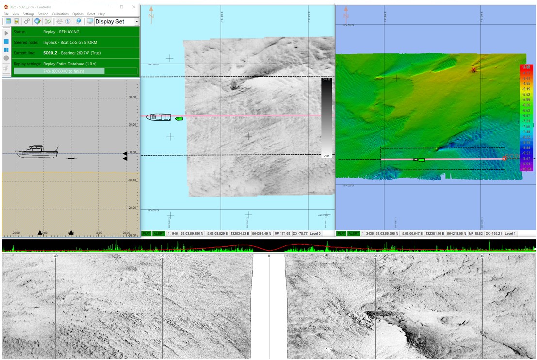
The Navigation Software is a fully integrated offshore survey navigation and acquisition platform designed to support precise positioning, data acquisition and real-time quality control during marine geophysical, hydrographic and geotechnical survey operations. The software integrates positioning sensors, survey instrumentation and vessel navigation into a single user interface, enabling survey personnel to monitor project progress and ensure accurate data collection throughout the operation.
The system provides simultaneous real-time displays of vessel position, planned survey lines, side scan sonar imagery, bathymetric surfaces and quality control parameters. Operators are able to monitor vessel heading, line deviation, sensor offsets, coverage and survey tolerances while navigating the vessel along predefined survey lines. The integrated display allows immediate identification of seabed features, survey gaps and navigation deviations, enabling corrective action to be taken during data acquisition.
Designed to interface with a wide range of offshore survey equipment, the Navigation Software supports DGPS/GNSS positioning systems, USBL and LBL acoustic positioning systems, multibeam echo sounders, side scan sonars, sub-bottom profilers, magnetometers, motion reference units (MRU), sound velocity sensors and other marine survey instruments. Real-time data logging and synchronization ensure that all positioning and sensor information is accurately recorded for subsequent processing and reporting.
The Navigation Software is suitable for a broad range of offshore survey applications including hydrographic surveys, pipeline and cable route investigations, offshore geophysical surveys, seabed mapping, offshore geotechnical investigations, construction support, pre-lay and post-lay inspections, dredging surveys and offshore renewable energy developments. The system provides survey teams with reliable navigation, comprehensive quality assurance and efficient project execution while maintaining the high positional accuracy required for offshore engineering projects.